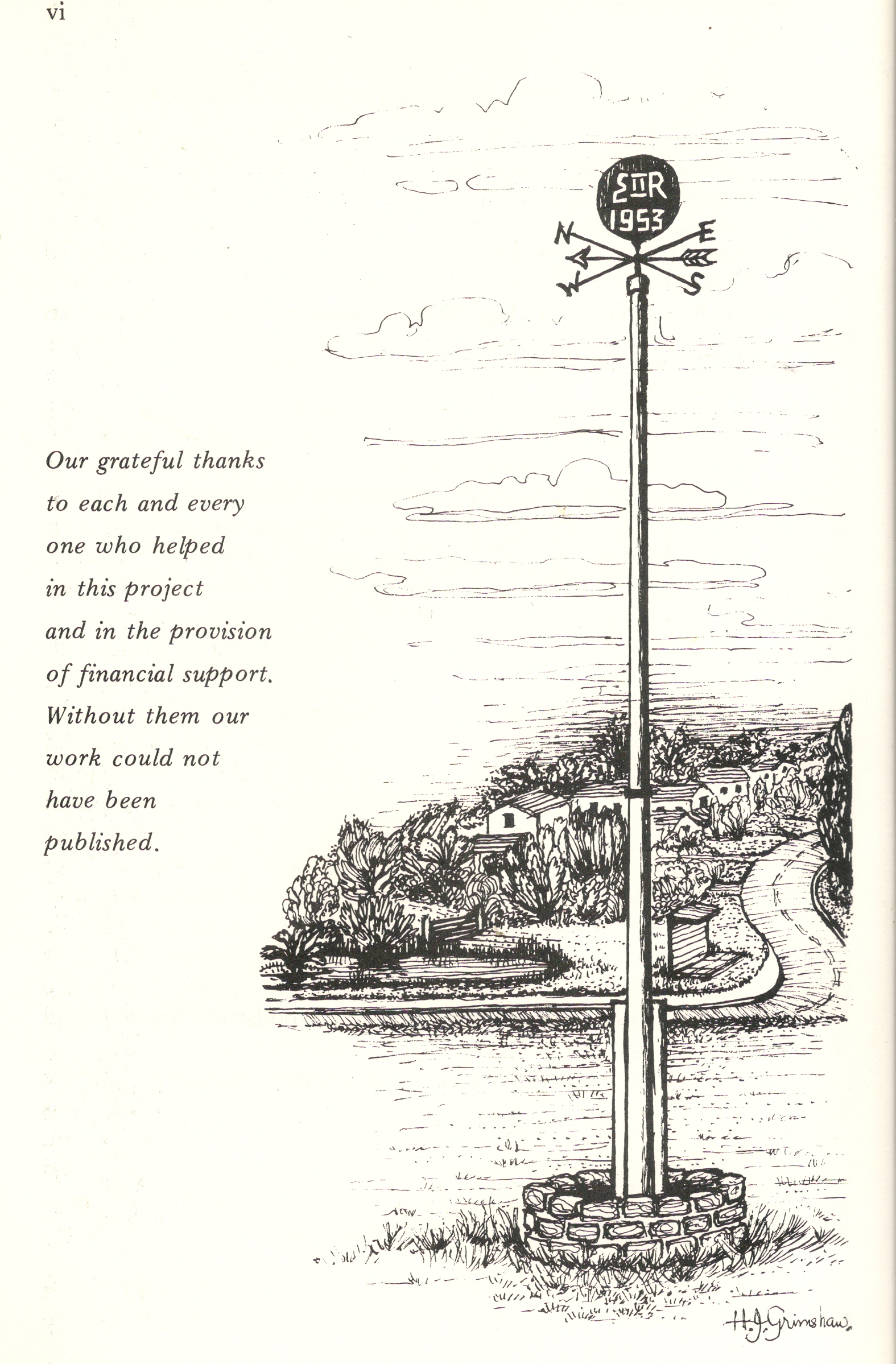
Wood Street Village Maypole
WOODSTREET – THE GROWTH OF A VILLAGE
Woodstreet is an enigma. To the outsider the question is mainly ‘Where is it?’ To the newcomer it is ‘How much is there?’ To the resident the question that most commonly occurs is ‘Why?’ Why did Woodstreet develop? And then ‘When?’ and ‘How?’
We, the Wood Street Village History Society, have attempted to find the answers to these questions. Our search has produced numerous legends. These are interesting and have been included because they are so. But history is concerned with the truth, and we have tried to uncover that truth: memoirs and hearsay have helped to direct our searches in the most successful directions. Sometimes we went off course, but as far as possible this book contains information gathered from primary sources, by which we mean records which were believed accurate in their own time, although officials can make mistakes. We have tried to indicate as clearly as possible where a legend is merely a story and where there is a fragment of evidence to support it.
Wood Street Village is situated between the north slope of the North Downs (Guildford to Farnham road) and the Guildford to Aldershot A323. It is in the Parish of Worplesdon, the Borough of Guildford and the County of Surrey. The access to the Village is at the Rydes Hill junction on the A323, and the single road through the Village rejoins this main road some two-and-a-half miles on, just before the modern Normandy boundary at Clasford. Our task as historians has been made more difficult by the fact that there is no natural or official boundary: Woodstreet was just part of a large parish, the ancient Parish of Worplesdon, which extended from Ash in the west to encompass Burpham in the east. Woodstreet did, however, form the major part of a tithing known as West End. But as most documents refer only to the parish of residence it has been an awesome task trying to identify Woodstreet residents and their dwelling-places.
The modern name was finally adopted as a convenient way to indicate to outsiders that Wood Street is not a road in Guildford. The Victorians called it Wood Street and attributed the name to the Roman occupation, but there is no evidence whatsoever of a Roman road. The medieval name was Woodstreet or Woodstreat. In those times the word ‘street’ was used in south-east England to describe a hamlet or group of houses served by a common thoroughfare.
The present population of Wood Street Ward is in the region of three-and-a-half thousand people, living in some twelve hundred and fifty dwellings. The population in 1851 of the slightly larger area of West End Tithing was five hundred and forty-four, living in one hundred and nine dwellings. We have not been able to use the historians’ formula to calculate what the population was in 1600, because our area is too small. There seems to have been eleven families, including three sets of brothers, living in Woodstreet and Broadstreet during the period 1600 to 1610. There is evidence, however, either architectural or documentary, of at least sixteen houses.
Geology
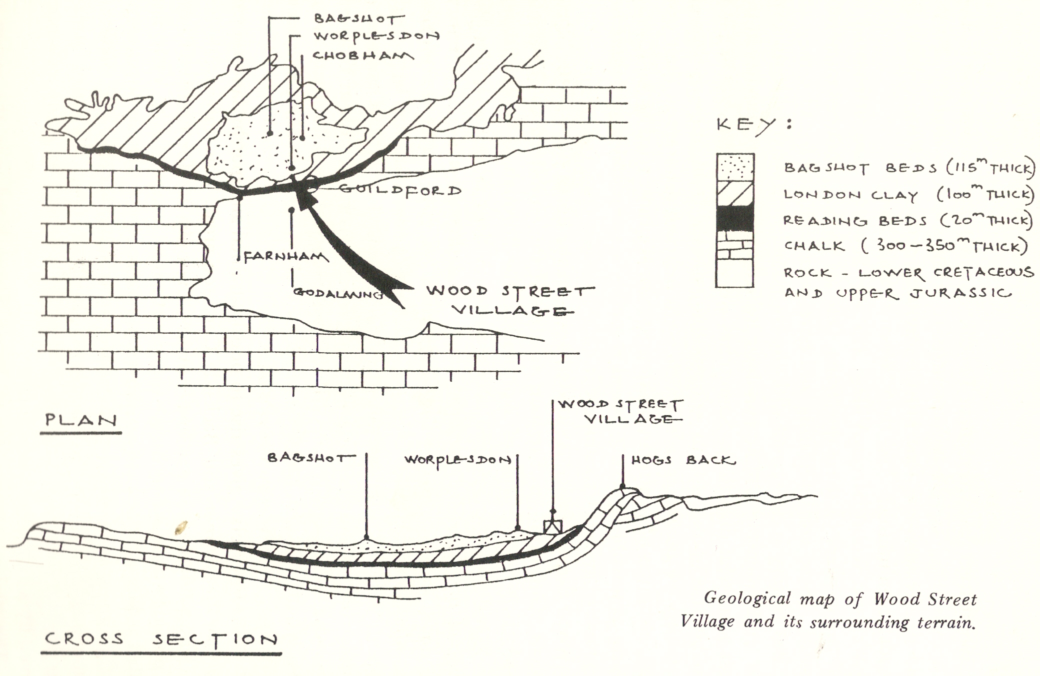
Geological Map of Wood Street Village
A geological map of Surrey shows why habitation in Wood Street developed so late in history: a geologist could have predicted that the area would be unsuitable for farming, dwelling or transport until technology had advanced far enough to overcome the difficulties posed by the land. There is, for example, no trace of any Iron or Bronze Age settlement.
Wood Street Village sits astride a narrow segment of London Clay, Parts of Frog Grove Lane are on sands (Bagshot Beds) and the railway line possibly marks where Reading Beds of sand begin to make their appearance.
Some thirty to sixty million years ago this area formed part of a great river delta or estuary. Fossils found in London Clay indicate that the climate was very warm at the time, about 20° Celsius (70° Fahrenheit), throughout the whole year. This Eocene period resulted in about a hundred metres of clay being deposited here, but it is up to three hundred metres thick in other parts of Surrey. Subsequent depositions, of sand for example, have been negated by the tilting of the land and by erosion. This means that the chalk lying under the clay is now exposed as the hills of the North Downs and Hog’s Back.
The sticky clay gives rise to poorly-drained and marshy land typified by the Broadstreet and Backside Common areas. This unfarmable land was called ‘waste’ in earlier centuries. The only use for London Clay is brick and pipe making; indeed, Rydes Hill was a very active area for both during the latter part of the nineteenth century. Many people will still claim that the damp clay is no fit place for human habitation.
The key to our history lies, as the cliché says, in the soil!
Roman Woodstreet
Wood Street Village abounds in legends about the Romans. It is generally believed that the name Woodstreet is Roman in origin, and many tell the tale of a Roman road which, because of the sticky clay, was made pontoon-style on logs. This legendary wooden street apparently ran more or less along the line of the present railway. The existence of a Roman villa at Broad Street Common is confused with a settlement. The naming of the local church after a Roman soldier saint has further consolidated the Latin myths of Wood Street.
A Roman villa was certainly built at some time between 250 and 400 A.D. The term villa is synonymous with our farmhouse. It is surprising that any farming should have been carried out in such wet deep clay or that any dwelling should have been erected so far from any known Roman settlement.
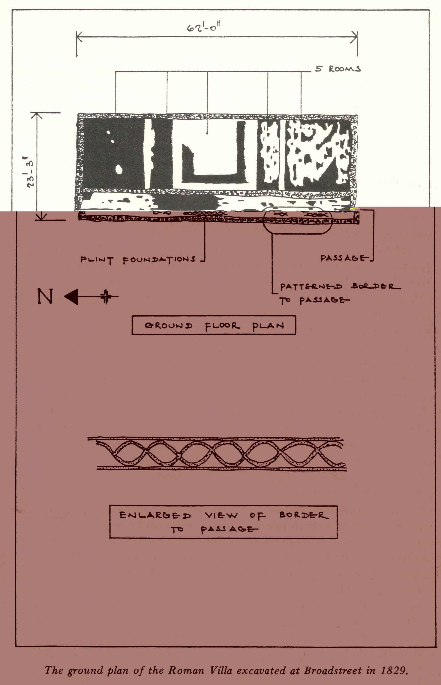
Roman Villa excavated in Broadstreet in 1829
The villa was discovered on 13th July, 1829. Labourers had been repairing local roads. They were directed to the site by the neighbouring tenant farmer, Mr. George Charman, who had frequently noticed that cattle chose that particular spot to rest, presumably because it was drier than anywhere else. The workmen found a quantity of flints, just what they needed, a few inches below the surface, and their attention was drawn to ornamental work of a lozenge shape in the flints. Unfortunately this was destroyed before anyone realised its antiquity.
More careful exploration revealed a floor of sixty-two feet in length and twenty-three feet in width. The centre compartment, forming a hollow square, is presumed to have been the surrounds of a bath or sudatory. On either side of this was the floor of a small room sixteen feet by five feet. Beyond these were two more rooms of sixteen feet by fourteen feet, and the five rooms were bounded by a passage on the western side. The majority of the floors were of ironstone, found in abundance in the sand hills south of Guildford. The tesserae, or tiles, were cut to about one inch square and were laid on eighteen-inch foundations of large flint-stones, with many pieces of brick and tile amongst the soil. Some of this rubble contained interesting pieces of curved tiles. The corridor was the best preserved, ornamented at its outer edge with a border formed of very small tesserae, arranged in a double-wavy pattern in the centre. The black ironstone and red clay-like tiles were set in a background of white, brown and yellow tiles formed from stained chalk. Three coins were found during the excavation. One was sufficiently well preserved to allow it to be dated to A.D. 286–293. The Earl of Onslow, Lord of the Manor, had the tiles removed to Clandon Park for their preservation but, sadly, there is now no record or trace of them. During the last war, when the site was ploughed, pottery fragments were found, mainly pieces of rims and lips, and some of these matched those known to have been made in Farnham kilns. There were also some fragments of Samian ware which could be earlier than A.D. 286, but we cannot use these finds to conclude that the site is earlier than has already been suggested: modern archaeologists would have been able to form better judgements from the foundation materials, if any had been left.
What the Domesday tells us
The Domesday Book shows that only six-and-a-half hides, about 780 acres, were under cultivation in the land at Werpesdune held by Earl Roger. The ancient Parish of Worplesdon, in comparison, covers about 7,140 acres. Twenty years earlier, in 1066, so the record states, eight hides (960 acres) were under cultivation. This simple record demonstrates how easily the forest reclaimed uncultivatable patches. It is unlikely that anyone would have attempted to plough Woodstreet’s heavy clay when Perry Hill soil was so much more workable. It is recorded that there were eight acres of meadow; woodland, and sixty pigs from pasturage. We think that the eight acres of meadow would have been near to the church and settlement too.
The Domesday record goes on to state that “two men at arms hold two hides and one virgate of this land. In lordship they have 2 ploughs, and 3 villagers and 2 small holders”. There is neither record nor clue to the whereabouts of these 270 acres; they could just as easily be in Perry Hill, Normandy, Burpham or Woodstreet. It would have been good to have claimed them, with their five residents, for Woodstreet, but a historian’s job is to look for facts, not to create new legends.
Murder at Rydes Hill
The Surrey Eyre Roll of 1235 records that a stranger was killed at Rydes Hill. “It is not known who killed him. No Englishry so murder.” The ‘No Englishry’ refers to the fact that it could not be proved that the murdered man was an Englishman. A fine was levied upon the Woking Hundred (the administrative area) for the murder of a Frenchman or Norman.